rogerpalmer.info
Photographs | Installations | Video | Books & Catalogues | Exhibitions | Texts | Contact | Links
Text:
| Meridian Roger Palmer, 2010 |
||||||||||||||||||
|
||||||||||||||||||
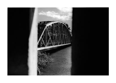
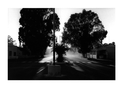
| Meridian comprises eleven pairs of silver gelatin photographs made in South Africa and the northern regions of Finland, Norway and Sweden. South Africa and Lapland (also known as Fenno-Scandia and Sápmi), are the most southerly and northerly inhabited lands along a single meridian. Meridian thus proposes links between two regions that are in different hemispheres and that appear to have little to connect them. But certain parallels between two areas that are thousands of miles apart and yet are in the same global time zone, led to an initial premise for making Meridian: a premise which expanded during periods of working in each area. Comparisons between rock paintings and carvings revealed remarkable similarities in early image making in these disparate northern and southern regions. Examples of rock art of similar age in Norway and South Africa include human figures of comparable scale and detail represented alongside simple images of local animals such as antelopes in the south or reindeer and elk in the north. The presence of such animals as cultural signifiers has continued in both regions, with reindeer featuring strongly in representations of Fenno-Scandinavian life while in South Africa the springbok has been associated with both air travel and sport. Between 1816 and 1855, an astronomer, Friedrich Georg Wilhelm Struve, undertook a survey that marked the first accurate measurement of a segment of a meridian. The Struve Geodetic Arc stretches from Hammerfest on the coast of northern Norway to the Black Sea, a distance of 2,820km. Using different markings such as a drilled hole in rock, an iron cross, cairns, or obelisks, the arc helped establish the size and shape of the earth and marked an important step in the development of topographic mapping across ten countries. Had the Struve Arc continued south, the final country that it would have crossed would have been South Africa, where Dutch and British colonizers had already established a problematic European presence at the time of the Struve survey. In the second half of the Twentieth Century, political movements in South Africa and Fenno-Scandia led to momentous changes and the recognition of the democratic rights of indigenous peoples over their colonisers. In South Africa, the 1994 elections marked the creation of a new democracy and the dismantling of black ‘homelands’. Following World War II, the Sámi won recognition rights and a common land, Sápmi, which traverses national borders. In the 1990s, Samí parliaments were established in Finland, Norway and Sweden. The active preservation and development of Sámi culture has since given rise to museums that document the emergence of Sámi nationhood. In South Africa, indigenous languages and cultures have flourished and museums documenting the political struggles of apartheid era have been constructed in Johannesburg, Cape Town and Port Elizabeth. |
||||||||||||||||||
* |
||||||||||||||||||
Meridian is the product of road journeys of similar length and duration made in South Africa and Fenno-Scandia in the first half of 2010, i.e. late summer in the southern hemisphere, early summer in the north. References to Scotland, my country of residence, figured in the planning and execution of both journeys. By navigating my way through all but one of South Africa’s provinces, I plotted a route through towns that bear colonial Scottish place-names. In Fenno-Scandia, much of the journey was spent crossing and re-crossing the Caledonian mountain chain that forms a natural border between coastal Norway and the tundra areas of northern Sweden and Finland. The Scottish Grampian Mountains form the most southerly section of the same geological mountain chain. |
||||||||||||||||||

